The Petermann Berg That Hit an Island and Survived
76 Square Kilometres, and It Survived
On August 4, 2026, a doctoral student named Adam Garbo was reviewing satellite imagery from the European Space Agency's Sentinel-1 mission when he noticed that something large had detached from Petermann Glacier, a marine-terminating glacier on Greenland's northwest coast. The ice island measured 76 square kilometres (29 square miles), comparable in area to the island of Manhattan, and was up to 150 metres (492 feet) thick. It was the largest calving event by any Arctic glacier since 2020, and the largest from Petermann itself since 2012, when a 130-square-kilometre island broke free. The calving in 2010 was 250 square kilometres: roughly three times the size of this one. Petermann has been losing mass in steps.
Petermann's Ice Tongue: What Is at Stake
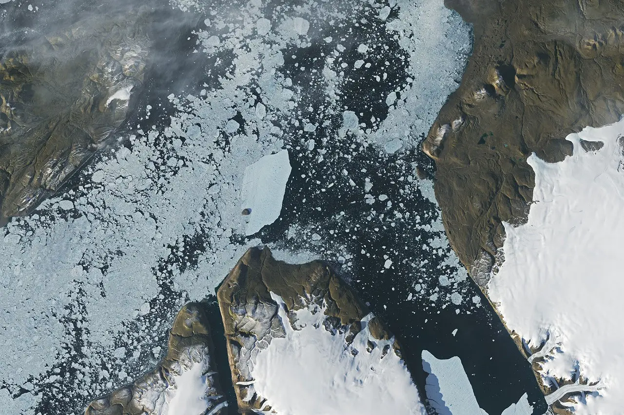
Petermann sits at the top of Nares Strait, the narrow channel separating Greenland from Ellesmere Island, Canada. Its floating tongue of ice acts as a brake on the glacier behind it: as long as the tongue is intact, it slows the flow of land-based ice into the sea. When large pieces calve away, that braking effect weakens, and ice that was stationary begins to move. Garbo, a glaciology PhD candidate at the University of Ottawa, had been watching a different rift, one that appeared likely to produce a larger ice island. "What surprised us was that the calving instead followed a different fracture, producing a smaller ice island than we had originally anticipated," he said.
August 23: The Approach to Joe Island
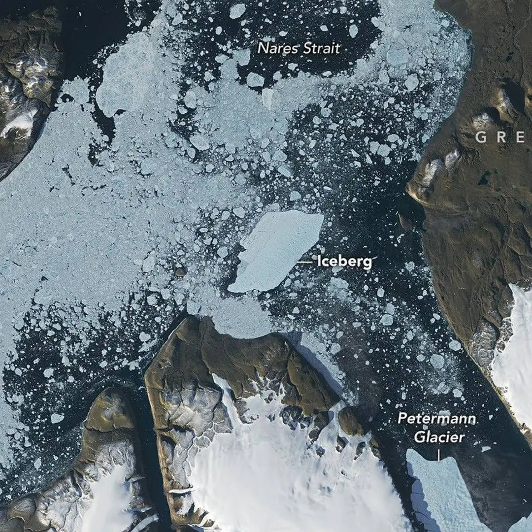
Petermann Fjord is about 70 kilometres long. An ice island breaking from the glacier must run that entire gauntlet before it reaches open water in Nares Strait. At the mouth of the fjord sits Joe Island, a small rocky outcrop that has a habit of ending the journeys of ice islands before they properly begin. The 2010 calving produced the largest Petermann ice island on record. When it reached Joe Island, the collision split it cleanly in two. Both halves continued drifting south, eventually reaching the Labrador Sea. NASA and USGS Landsat 9 satellites captured images on August 23 and August 24 as this year's ice island approached, struck, and cleared the same obstacle. Glaciologist Mauri Pelto of Nichols College tracked the drift rate using the Landsat data: the berg was moving at an average of 1.8 miles (3 kilometres) per day in the week after calving.
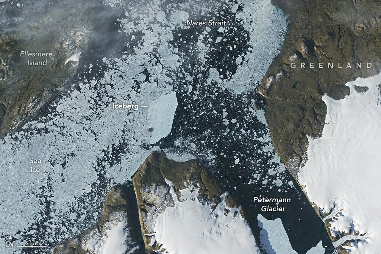
The August 24 Landsat 9 image shows the ice island clearing Joe Island intact and continuing into Nares Strait.
The open water visible on August 24 that was covered in brash ice on August 23 is the path the berg carved through.
""What surprised us was that the calving instead followed a different fracture, producing a smaller ice island than we had originally anticipated." Adam Garbo, glaciology PhD candidate, University of Ottawa
"Steph1st of October 2026

Two More Rifts Are Still Open
The collision did not break the ice island. As of early September it continues drifting south through Nares Strait, where Environment and Climate Change Canada is monitoring potential risks to shipping routes.
What concerns glaciologists more than this berg is what remains attached to the glacier.
Two large rifts are still present in Petermann's ice tongue. Researchers estimate the first could eventually release a fragment of roughly 94 square kilometres and the second roughly 84 square kilometres. Neither break is imminent, but both rifts are active and widening. The total potential loss, if both release, would be approximately 254 square kilometres of additional floating ice, nearly three times what calved in August. As that ice melts, it does not directly raise sea levels (floating ice displaces the water it sits in), but the loss of the ice tongue accelerates the flow of land-based ice behind it into the ocean, and that does.
Ice island size (August 2026)
76 km2 (29 sq mi)
Previous largest from Petermann
130 km2 (2012)
Ice island thickness
up to 150 m (492 ft)
Drift speed (first week)
3 km per day
Remaining rifts, potential release
94 km2 and 84 km2
Last larger Arctic calving event
2020
The Wider Pattern
Petermann has lost major sections of its floating tongue in 2008, 2010, 2012, and now 2026. Each calving sets a new lower baseline: the tongue that remains is shorter than it was before, leaving less ice to buffer what flows from the land behind it. The 2026 event was detected in real time, tracked in near-real time by multiple satellite systems, and published within weeks by NASA's Earth Observatory. The surveillance is getting better. The glacier, by every measure, is not.