Super Typhoon Bavi 2026
Typhoon Bavi
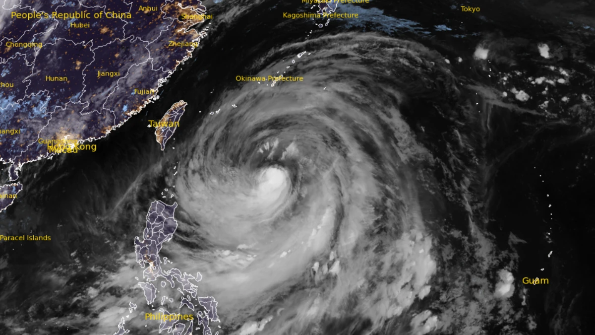
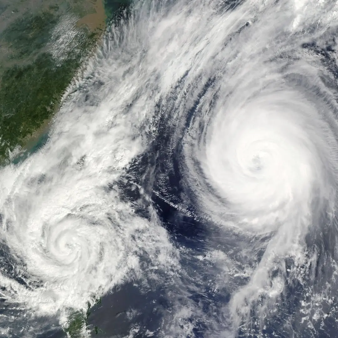
Super typhoon. Category 5 at peak intensity. Maximum winds 250 km/h. Diameter roughly 850 times the
Peak sustained winds
250 km/h (Category 5 equivalent)
Storm diameter
Approximately 850x the area of Hong Kong
Landfall zone
Fujian and Zhejiang provinces, eastern China
Expected dissipation
Near Shanghai by July 13, 2026
China alert level
Orange (second highest on the national scale)
Previous landfall
Northern Mariana Islands as Category 5, early July
How Bavi Got So Strong
Typhoon Bavi formed over anomalously warm sea surface temperatures in the western Pacific, a pattern that has become more common since 2022 as ocean heat content at depth has risen. Warm water is the fuel of tropical cyclones. When the typhoon crossed the Northern Mariana Islands as a Category 5 last week, it was already one of the most powerful storms of the 2026 season. It weakened slightly as it tracked northwest over open water, but intensified again over the warm Kuroshio Current before curving toward the Chinese coast. By the time it approached Fujian, its cloud shield covered a swath of ocean larger than the entire island of Great Britain. The Chinese meteorological authority issued an orange alert, the second highest on a four-tier scale, triggering mass evacuations along the Zhejiang and Fujian coastlines. Tens of thousands of fishing vessels were recalled to port in the days before landfall.
Super typhoons are not simply bigger hurricanes. The western Pacific is the most active tropical cyclone basin on Earth, producing more Category 4 and 5 storms per year than the Atlantic and eastern Pacific combined. Sea surface temperatures in the region in July 2026 are running 1.2 degrees Celsius above the 1991 to 2020 average, according to NOAA data released this week.
Bavi's path: region by region
The Northern Mariana Islands (Early July): Bavi made its first landfall as a full Category 5 on the Commonwealth of the Northern Mariana Islands, bringing maximum gusts above 280 km/h to Saipan and Tinian. Infrastructure damage was severe. Power and water were still being restored when Bavi had already moved on. The CNMI has a population of roughly 51,000. Taiwan (July 8 to 9): Tracking slightly north of its earlier forecast, Bavi clipped northeastern Taiwan with its outer rainbands before making open water again. The Central Weather Administration recorded more than 400 mm of rain in Yilan County in under 24 hours. Landslides closed the Suhua Highway. No fatalities were reported on the island but the damage to agricultural infrastructure was described as significant. Fujian Province (July 10, now): Bavi is making landfall right now. The province, home to cities including Fuzhou, Xiamen, Quanzhou, and Zhangzhou, has pre-positioned more than 1,300 emergency response teams. The city of Fuzhou issued a standstill order covering government offices, schools, and public transit. Xiamen, a city of 5.3 million and a major shipping hub, cancelled all air and sea services from midnight. Zhejiang Province (July 10 to 11): The storm's northern wall is expected to sweep across Zhejiang, including Wenzhou, Taizhou, and Hangzhou. Wenzhou sits in a coastal low, which compounds storm surge risk. The province ordered suspension of high-speed rail services on coastal routes and suspended all maritime traffic. Zhejiang has been hit by severe typhoons before: Lekima in 2019 caused 49 deaths and over 50 billion yuan in damage. Shanghai (July 12 to 13): Bavi is forecast to weaken sharply once inland, losing its warm-water energy source. By the time it reaches the Shanghai region it is expected to be a tropical storm or severe tropical storm. Even so, 90 to 200 mm of rain is forecast for metropolitan Shanghai, a city of 24 million. The government has pre-positioned flood barriers along the Huangpu River. Officials are monitoring the risk of combined river flooding and coastal surge.
Typhoons and China's coast: a historical pattern. The coastline from Fujian to Jiangsu is one of the most typhoon-exposed stretches of populated shoreline on the planet. Since 2000, major typhoons hitting this corridor have caused billions of yuan in losses and displaced millions of people. Lekima (2019) and Maria (2018) are the most recent Category 3 or above storms to have made direct landfalls in roughly this zone. Bavi, at peak Category 5 strength, is exceptional even by that standard.