The Crater at the End
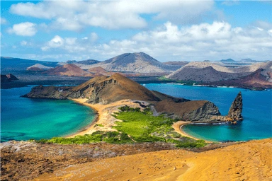
The Quilotoa Loop links a chain of indigenous villages across the high Ecuadorian Andes, walked over three days from Sigchos through Isinlivi and Chugchilan to the rim of the Quilotoa crater. The path crosses canyons, river valleys and patchwork farmland with simple family run hostels at each stop. The finish is the payoff, a violently green lake filling an old volcanic caldera nearly 250 metres deep.
Duration
3 days
Distance
35 km
Elevation gain
1600 m
Difficulty
Strenuous, altitude
Quilotoa rim
3914 m
You stay in village hostels along the way, so you only need a day pack. Buses run back from Quilotoa to Latacunga at the end.
The whole route sits above 2800 metres and tops out near 3900. Spend a day or two acclimatising in the highlands before you start.